Aravalli Crisis: A Billion-Year-Old History Shield Faces an Existential Threat
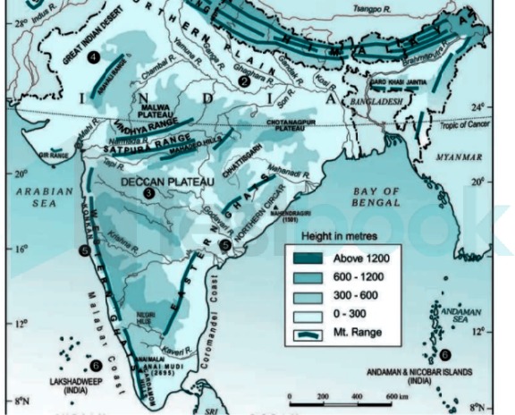
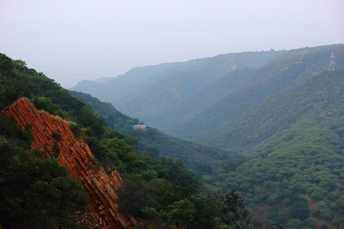
Aravalli mountain range is located in northwestern India, extending from Palanpur in Gujarat in the southwest to Delhi. Its average height ranges from 300 to 900 meters.

Aravalli Crisis: The Aravalli mountains were formed when the Ganges River didn't exist, the Himalayas hadn't formed, continents were still joining together, and life was just beginning to originate. There are now talks of reducing the height of these mountain ranges, which are 250 crore years old. This is like saying we should eliminate all short-statured creatures from this world. The Aravalli mountain range, spread across the land of India, is not only a geographical marvel but also one of the oldest mountain ranges in the world. Extending across Rajasthan, Haryana, Gujarat, and Delhi, this range is approximately 670 kilometers long. 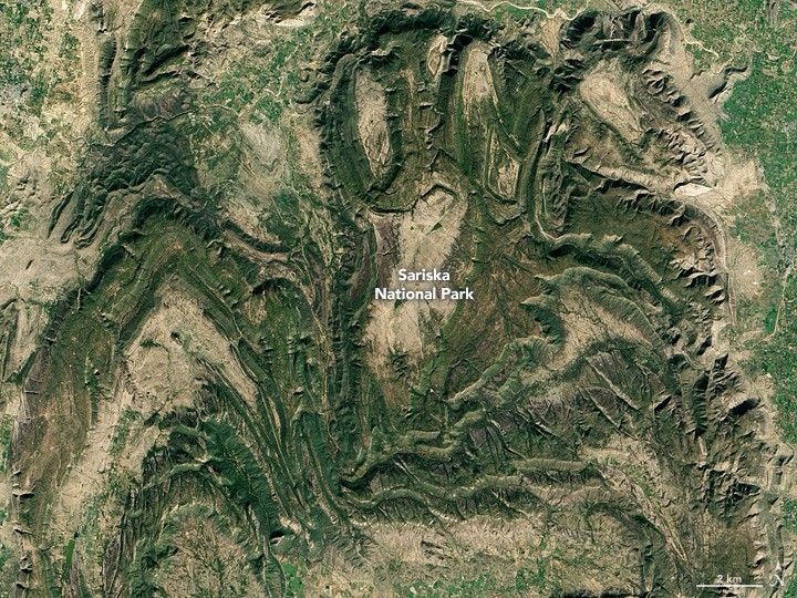
 The Earth's crust is divided into several plates that float on the mantle (the Earth's second layer). These plates move slowly, a few centimeters per year. When two plates collide, the crust folds, rises, and mountains are formed. In the case of the Aravalli, it was formed by the collision of three major cratons – the Bundelkhand Craton, the Rajasthan Craton, and others. This process is known as the 'Aravalli-Delhi Orogeny'. Also Read: You can celebrate New Year in low budget and clean air away from Delhi’s pollution, know here During the Proterozoic Eon, the continents on Earth were different. The formation of the Aravalli began when seafloor rocks (such as volcanic rocks, carbonates, and rocks composed of granite) came under pressure. This occurred in a 'geosyncline' (a marine trough) where rocks accumulated and were then folded by tectonic pressure. The Banded Gneiss Complex (BGC) forms its main part, which was completed 2.5 billion years ago.
  What was India like?... At that time, life on Earth was primarily in the oceans – bacteria and algae. There were no plants or animals on land. The climate was hot and humid, as there was less oxygen in the atmosphere. The oceans contained iron-rich water, which formed Banded Iron Formations. There were oceanic trenches in the Aravalli region where pressure was building up. This pressure was released due to the collision. This caused the upper layer of the crust to fold, and mountains were formed.
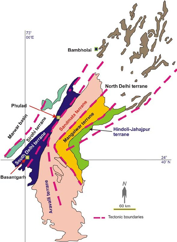
Its history is intertwined with the ancient history of the Earth
According to scientists, the Aravalli range was formed during the Proterozoic era, which began approximately 250-350 crore years ago. This range not only influences India's climate and environment but also plays a crucial role in preventing the expansion of the Thar Desert. Significance and Introduction of the Aravalli Range
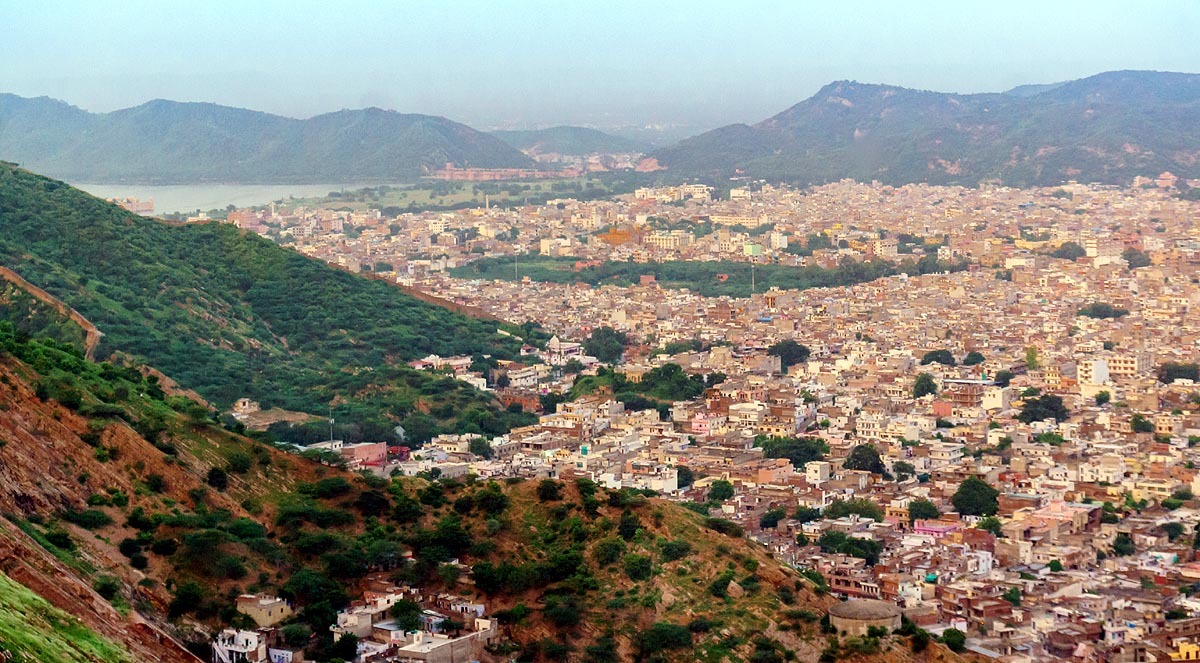
The Aravalli mountain range is located in northwestern India, extending from Palanpur in Gujarat in the southwest to Delhi. Its average height ranges from 300 to 900 meters. The highest peak is Guru Shikhar, which is 1,722 meters high. It is located in Mount Abu, Rajasthan's only hill station. The name Aravalli comes from the Sanskrit word 'Aravalli', meaning "row of stones." This range acts like a natural wall for India, preventing the expansion of the Thar Desert and protecting northern India from dry and hot winds. 'Aravalli', meaning "row of stones”
Scientifically, the Aravalli is one of the oldest mountain ranges in the world. While younger mountain ranges like the Himalayas are only about 5 crore years old, the Aravalli's history is more than 250 crore years old. It is a product of the Proterozoic era, when major changes were occurring in the Earth's crust. The Aravalli Range is not just a book of geological history; it is rich in minerals and the source of several rivers, such as the Luni, Banas, and Sabarmati. Its forests are teeming with biodiversity, home to rare plants and animals. The Aravalli's contribution is multifaceted. It maintains environmental balance, aids in water conservation, and is economically significant due to the presence of minerals like marble, zinc, and copper. However, its condition is currently threatened by illegal mining and urbanization. Also Read: When will Kalpavas begin? Note the dates and rules for Sangam bathingFormation of the Aravalli: How and when were these mountains formed?
The Aravalli mountain range is the result of a long geological process called orogeny, which is the process by which mountains are formed through the collision of Earth's tectonic plates. The Aravalli's case is slightly different because it is very ancient. It was formed during the Proterozoic Eon (approximately 2.5 billion to 540 million years ago). Specifically, its main formation occurred 1.8 billion years ago when ancient cratons (pieces of Earth's old, stable crust) collided. The Earth's crust is divided into several plates that float on the mantle (the Earth's second layer). These plates move slowly, a few centimeters per year. When two plates collide, the crust folds, rises, and mountains are formed. In the case of the Aravalli, it was formed by the collision of three major cratons – the Bundelkhand Craton, the Rajasthan Craton, and others. This process is known as the 'Aravalli-Delhi Orogeny'. Also Read: You can celebrate New Year in low budget and clean air away from Delhi’s pollution, know here During the Proterozoic Eon, the continents on Earth were different. The formation of the Aravalli began when seafloor rocks (such as volcanic rocks, carbonates, and rocks composed of granite) came under pressure. This occurred in a 'geosyncline' (a marine trough) where rocks accumulated and were then folded by tectonic pressure. The Banded Gneiss Complex (BGC) forms its main part, which was completed 2.5 billion years ago. Age has been estimated from 36 samples across various mineral districts
How long has this range existed? For approximately 2.5 billion years, but its height has been reduced due to continuous erosion. Today, these hills are old and worn down, but their rocks tell a story of ancient history. At the time of the Aravalli's formation, India, as we know it today, did not exist. It was the Proterozoic Eon, when the Earth's continents were separate and supercontinents were forming. The Indian subcontinent was part of a supercontinent called 'Columbia', which existed between 1.8 and 1.5 billion years ago. According to ancient geography, the Indian cratons (such as Dharwar, Bundelkhand, Aravalli) were moving in north-south and east-west directions. A collision occurred in the Satpura Mobile Belt between the Bundelkhand and Bhandara cratons. At that time, India was located near the equator, but the precise latitude and longitude come from paleomagnetic data. Paleomagnetic studies of the Dharwar and Bundelkhand cratons suggest that it was in the Southern Hemisphere. What was India like?... At that time, life on Earth was primarily in the oceans – bacteria and algae. There were no plants or animals on land. The climate was hot and humid, as there was less oxygen in the atmosphere. The oceans contained iron-rich water, which formed Banded Iron Formations. There were oceanic trenches in the Aravalli region where pressure was building up. This pressure was released due to the collision. This caused the upper layer of the crust to fold, and mountains were formed. India was a small continent at that time, which later joined Gondwana.
Contribution of the Aravalli: From a Scientific Perspective...
Environmental Contribution: It is 'India's natural green wall,' preventing the Thar Desert from spreading eastward. Without the Aravalli Range, Rajasthan and Haryana would be much drier. It influences monsoon winds, increasing rainfall. Water Conservation: The Aravalli Range is the source of several rivers. These rivers are crucial for agriculture and drinking water. Scientifically, it helps in the water cycle – rainwater seeps into the rocks and forms groundwater. It acts like a natural sponge, sending rainwater down into the ground. Mineral Contribution: The Aravalli Range is rich in minerals. Zinc, lead, copper, silver, and marble are found here. The mining industry is thriving in the Udaipur and Rajsamand regions. Biodiversity: It is an ecological hotspot. It is home to over 300 bird species, and animals like leopards and sloth bears. Plants include neem, acacia, and dhok trees. Scientific studies show that this region is a repository of ancient vegetation. It serves as a vast corridor for animals and plants. Cultural and Historical: The Aravalli Range has ancient forts and temples. It is associated with Rajput history. Its rocks are important for studying the Earth's history. Economic Contribution: Mining provides employment but also causes environmental damage. Scientists say that sustainable development is necessary. Current Situation and Challenges
Today, the Aravalli Range is under threat. Illegal mining has destroyed 20% of the area. Climate change is reducing rainfall. The government is running the Aravalli Green Wall Project. Scientists have suggested that preserving and expanding the forests here is crucial. Controlling mining is also essential.Summary
The Aravalli Range is India's ancient heritage, formed by tectonic collisions. It is 2.5 billion years old. At that time, India was part of a supercontinent. Its contribution is significant to the environment, economy, and science.
Alka
Next Story